The only thing that makes Lake Superior a lake instead of a sea is the freshwater.

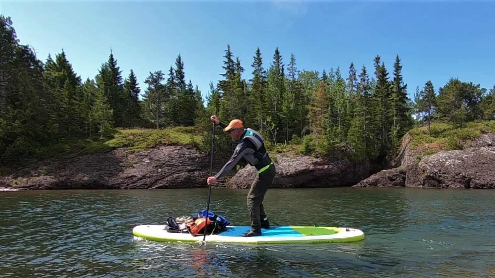
Keweenaw Peninsula has miles of rugged wilderness coastline ready for exploring with a paddle board.
Keweenaw Peninsula is the most northern part of Michigan’s Upper Peninsula extending up into the cold waters of Lake Superior. Copper Harbor is near the tip of the Keweenaw Peninsula. Keweenaw Penninsula was the site of the first copper boom in the United States.
This video footage was taken just west of Horseshoe Harbor.
Horseshoe Harbor is owned by the Nature Conservancy. It has a rocky beach and a few scenic rock stacks at the mouth. Land access is via a 1/2 mile foot trail. No camping is allowed there.
Conditions were often windy and paddling upwind was a chore. Lake Superior weather can change in a minute and small storms can appear out of nowhere. As usual the water was clear. I could see massive rock slabs on the bottom almost 30′ deep.
The weather was warm and a perfect day for SUP touring. The air temperature was 75-80 degrees. But the waters of Lake Superior peaked at a temperature of only 63 degrees.
I could see massive rock slabs on the lake bottom almost 30′ deep.
South of Copper Harbor is an even more scenic rocky coastline all the way down to Agate Harbor. Unfortunately the land from Agate to Copper Harbor is private and there is no public access. It has to be paddled in one 7 mile stretch.
This part of the coastline has a lot of rock outcroppings and can be dangerous. In particular there is a spot called the Devil’s Washtub that can only be approached in calm seas.
On this trip I never paddled south of Copper Harbor. The stretch of coastline from Agate to Copper Harbor can be done but takes some planning and decent weather.
See video sup touring around rock stacks at mouth of Horseshoe Harbor
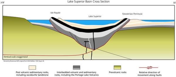
The Mid Continent Rift
Keweenaw Geoheritage: Redbeds fill the Great Rift Valley from Bill Rose on Vimeo.

